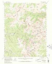
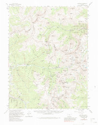
1958 Map of Montezuma
USGS Topo · Published 1972About this map
The Continental Divide serves as the backbone for this high-altitude survey, where the mining legacies of the mid-20th century meet the early expansion of Colorado's recreation industry. High peaks like Grays Peak and Torreys Peak dominate the skyline above the Arapaho National Forest, while the valley floors reveal established mining districts. The settlement of Montezuma sits at the heart of a dense network of tunnels and shafts, including the Saints Johns Mine and the Pennsylvania Mine along Peru Creek. This era captures the transition of the landscape toward winter sports, clearly marking the Arapahoe Basin Ski Area and Loveland Ski Area. Evidence of older, high-mountain camps such as Saints Johns, Tiger, and Swandyke provides a detailed look at the footprint of the silver and gold rushes before the modern development of the Snake River valley intensified.
Find a feature on this map
118 named features on this map. Tap any name to fly to it.
Don’t see what you’re looking for? This feature index may not catch every label — zoom into the map to look around manually.
Map Details
Editions of this 1958 Montezuma Map
5 editions found
Other maps of this area

1889 · Leadville
USGS Topo · 1:125,000

1891 · Leadville
USGS Topo · 1:125,000

1903 · Georgetown
USGS Topo · 1:62,500

1905 · Central City
USGS Topo · 1:62,500

1905 · Georgetown
USGS Topo · 1:62,500

1910 · Central City
USGS Topo · 1:62,500

1912 · Central City
USGS Topo · 1:62,500

1924 · Montezuma
USGS Topo · 1:62,500

1924 · Fraser
USGS Topo · 1:62,500

1926 · Fraser
USGS Topo · 1:62,500