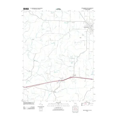
2012 Map of Montgomery City
USGS Topo · Published 2012About this map
Montgomery City anchors the northern reaches of this Missouri landscape, where the local road network fans out from a grid of streets like N Walker St and Pickering St. The terrain is defined by the winding course of the Loutre River and its numerous tributaries, including McIntosh Branch and Sallee Branch. This drainage pattern has historically influenced the placement of rural homesteads and family burial grounds, such as Providence Cemetery and Worland Cemetery, which remain preserved amidst the agricultural fields.
Find a feature on this map
87 named features on this map. Tap any name to fly to it.
Don’t see what you’re looking for? This feature index may not catch every label — zoom into the map to look around manually.
Map Details
Editions of this 2012 Montgomery City Map
This is the sole edition of this map. No revisions or reprints were ever made.
Other maps of this area

1890 · Louisiana
USGS Topo · 1:125,000

1890 · Mexico
USGS Topo · 1:125,000

1890 · Hermann
USGS Topo · 1:125,000

1890 · Fulton
USGS Topo · 1:125,000

1940 · Montgomery City
USGS Topo · 1:62,500

1942 · Montgomery City
USGS Topo · 1:62,500

1942 · Wellsville
USGS Topo · 1:62,500

1942 · New Florence
USGS Topo · 1:62,500

1942 · Bellflower
USGS Topo · 1:62,500

1945 · Bellflower
USGS Topo · 1:62,500