Loading...
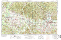
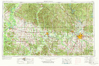
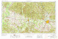
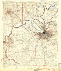
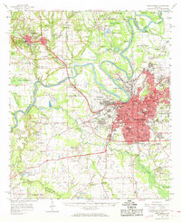
Loading map...1953 Map of Montgomery
USGS Topo · Published 1978About this map
The Alabama River anchors this regional landscape, winding from the confluence of the Coosa River and Tallapoosa River near Montgomery westward toward Selma and Demopolis. During this mid-century period, the area reflects a transition from river-based commerce to a heavy reliance on a maturing rail network, including the Southern Railway and the Western Railway of Alabama. Military aviation plays a significant role in the local economy and geography, with Maxwell AFB, Gunter AFB, and Craig AFB established as major landmarks.
Find a feature on this map
158 named features on this map. Tap any name to fly to it.
Don’t see what you’re looking for? This feature index may not catch every label — zoom into the map to look around manually.
Map Details
Date Portrayed1953
Date Published1978
PublisherU.S. Geological Survey
Map TypeTopographic
Scale1:250,000
Physical Dimensions32.9 x 21.8 inches
Editions of this 1953 Montgomery Map
4 editions found

Historical Maps of Montgomery Through Time
7 maps found


Featured Locations
Source Details
SourceU.S. Geological Survey
CopyrightPublic Domain