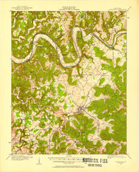
1911 Map of Monticello
USGS Topo · Published 1958About this map
Monticello serves as the focal point of this survey, surrounded by a dense network of rural community centers and small-scale agriculture at the turn of the century. The Cumberland River meanders across the northern portion of the quadrangle, punctuated by vital transportation nodes such as Rankin Landing, Eads Landing, and Thomas Landing. These river crossings, along with the Burnside Road, formed the essential commercial arteries for Wayne County before modern infrastructure transformed the region.
Find a feature on this map
96 named features on this map. Tap any name to fly to it.
Don’t see what you’re looking for? This feature index may not catch every label — zoom into the map to look around manually.
Map Details
Editions of this 1911 Monticello Map
2 editions found
Other maps of this area

1911 · Monticello
USGS Topo · 1:62,500

1914 · Monticello
USGS Topo · 1:62,500

1929 · Byrdstown
USGS Topo · 1:62,500

1932 · Burnside
USGS Topo · 1:62,500

1934 · Barthell
USGS Topo · 1:62,500

1934 · Pall Mall
USGS Topo · 1:62,500

1935 · Somerset
USGS Topo · 1:62,500

1953 · Frazer
USGS Topo · 1:24,000

1953 · Parnell
USGS Topo · 1:24,000

1953 · Monticello
USGS Topo · 1:24,000