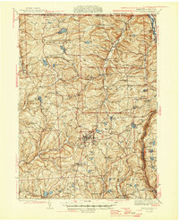
1945 Map of Montrose
USGS Topo · Published 1945About this map
Montrose serves as the central hub of this Susquehanna County landscape, where the plateau terrain is deeply incised by the drainage of Snake Creek and Wyalusing Creek. This mid-century survey reveals a dense network of rural infrastructure, from the small crossroads at Franklin Forks to the numerous district schoolhouses that once served these upland townships, such as Kano Sch and Hamlin Sch. The map illustrates a local economy shifting from early industry, represented by Fisk Mill and Snows Mill, toward a recreational and agricultural landscape.
Find a feature on this map
98 named features on this map. Tap any name to fly to it.
Don’t see what you’re looking for? This feature index may not catch every label — zoom into the map to look around manually.
Map Details
Editions of this 1945 Montrose Map
2 editions found

Other maps of this area

1892 · Dundaff
USGS Topo · 1:62,500

1901 · Apalachin
USGS Topo · 1:62,500

1904 · Binghamton
USGS Topo · 1:62,500

1904 · Apalachin
USGS Topo · 1:62,500

1905 · Nineveh
USGS Topo · 1:62,500

1906 · Catatonk
USGS Topo · 1:125,000

1932 · Susquehanna
USGS Topo · 1:62,500

1935 · Binghamton West
USGS Topo · 1:24,000

1935 · Susquehanna
USGS Topo · 1:62,500

1937 · Binghamton East
USGS Topo · 1:24,000