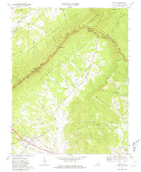
1967 Map of Montvale
USGS Topo · Published 1981About this map
Montvale and the community of Lithia anchor this survey of the Virginia highlands during the late 1960s. The landscape is defined by the sharp divide between the Jefferson National Forest and the agricultural valleys below. High-altitude infrastructure is prominent, with the Blue Ridge Parkway winding past numerous scenic points such as Sharp Top Overlook and Iron Mine Hollow Overlook. Hikers can trace the Appalachian Trail as it follows the crest of the Blue Ridge mountains, crossing through Harveys Knob and Mills Gap Overlook.
Find a feature on this map
61 named features on this map. Tap any name to fly to it.
Don’t see what you’re looking for? This feature index may not catch every label — zoom into the map to look around manually.
Map Details
Editions of this 1967 Montvale Map
Other maps of this area

1890 · Roanoke
USGS Topo · 1:125,000

1891 · Roanoke
USGS Topo · 1:125,000

1894 · Natural Bridge
USGS Topo · 1:125,000

1894 · Natural Bridge
USGS Topo · 1:62,500

1907 · Natural Bridge Special
USGS Topo · 1:62,500

1913 · Eagle Rock
USGS Topo · 1:48,000

1915 · Eagle Rock
USGS Topo · 1:62,500

1929 · Roanoke
USGS Topo · 1:48,000

1933 · Roanoke
USGS Topo · 1:62,500

1947 · Roanoke
USGS Topo · 1:250,000