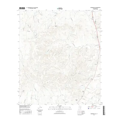
2016 Map of Monument Hill
USGS Topo · Published 2016About this map
Monument Hill and Brushy Top anchor this central Texas landscape, where the drainage patterns of the Hill Country dictate the placement of ranch roads and remote airstrips. The area is defined by a dense network of seasonal and perennial waterways, including the winding Miller Cr and the convergence of the W Fork Hinds Br and E Fork Hinds Br. Development in this era remains primarily agricultural and residential, characterized by large ranch properties like those served by Rocky Top Ranch Airport. Cultural traces are visible in the naming of prominent terrain and water features such as Martin Mtn and Walnut Spring. The layout of local thoroughfares like Cattle Cr Rd and Klappenbach Rd follows the natural contours of the limestone ridges and valleys, illustrating the enduring relationship between the topography and rural Texas land use.
Find a feature on this map
67 named features on this map. Tap any name to fly to it.
Don’t see what you’re looking for? This feature index may not catch every label — zoom into the map to look around manually.
Map Details
Editions of this 2016 Monument Hill Map
This is the sole edition of this map. No revisions or reprints were ever made.
Other maps of this area

1887 · Blanco
USGS Topo · 1:125,000

1894 · Fredericksburg
USGS Topo · 1:125,000

1894 · Blanco
USGS Topo · 1:125,000

1954 · Llano
USGS Topo · 1:250,000

1955 · Llano
USGS Topo · 1:250,000

1956 · Llano
USGS Topo · 1:250,000

1961 · Hye
USGS Topo · 1:24,000

1961 · Rocky Creek
USGS Topo · 1:24,000
1961 · Johnson City
USGS Topo · 1:24,000

1963 · Yeager Creek
USGS Topo · 1:24,000