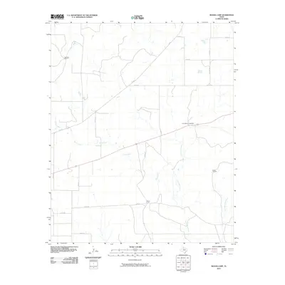
2010 Map of Moons Camp
USGS Topo · Published 2010About this map
Moons Camp and the surrounding ranchlands of Cottle County are defined by a sparse network of county roads and vital water sources in this 2010 study. The landscape is oriented around the drainage of Shorty Creek and Cottonwood Creek, with infrastructure primarily supporting livestock and rural transit. Notable local landmarks include the L V Anderson Lake Dam and functional ranching features such as the Red Tower Windmill and Divide Windmill, which emphasize the area's continued reliance on managed water in the Texas Panhandle. The map provides a detailed view of the regional road system, including FM 104 and Ranch RD 2532, connecting the isolated camp and windmills to the broader county infrastructure during the first decade of the 21st century.
Find a feature on this map
22 named features on this map. Tap any name to fly to it.
Don’t see what you’re looking for? This feature index may not catch every label — zoom into the map to look around manually.
Map Details
Editions of this 2010 Moons Camp Map
This is the sole edition of this map. No revisions or reprints were ever made.
Other maps of this area

1954 · Lubbock
USGS Topo · 1:250,000

1954 · Plainview
USGS Topo · 1:250,000

1958 · Plainview
USGS Topo · 1:250,000

1967 · Dunlap
USGS Topo · 1:24,000

1967 · Triangle Ranch
USGS Topo · 1:24,000
1967 · Baker
USGS Topo · 1:24,000

1967 · Paducah
USGS Topo · 1:24,000

1967 · Moons Camp
USGS Topo · 1:24,000
1967 · Swearingen
USGS Topo · 1:24,000

1968 · Y Ranch
USGS Topo · 1:24,000