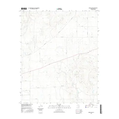
2016 Map of Moons Camp
USGS Topo · Published 2016About this map
Moons Camp and its surrounding ranch lands define this corner of West Texas, captured here in the mid-2010s. The landscape is deeply carved by the drainage networks of Shorty Cr, Cottonwood Cr, and E Cottonwood Cr, which snake through the varied terrain. This area of Cottle County is characterized by a sparse, utilitarian network of rural routes, including Fm 104, Ranch Rd 104, and several numeric county roads like Co Rd 410 and Co Rd 324. The concentration of named ranch roads and specific creek branches reflects a region primarily organized around livestock and land management, where named landmarks often center on established camps and water sources. Researchers can use this data to trace modern property access points and historical water rights along the various forks of Cottonwood Cr.
Find a feature on this map
22 named features on this map. Tap any name to fly to it.
Don’t see what you’re looking for? This feature index may not catch every label — zoom into the map to look around manually.
Map Details
Editions of this 2016 Moons Camp Map
This is the sole edition of this map. No revisions or reprints were ever made.
Other maps of this area

1954 · Lubbock
USGS Topo · 1:250,000

1954 · Plainview
USGS Topo · 1:250,000

1958 · Plainview
USGS Topo · 1:250,000

1967 · Dunlap
USGS Topo · 1:24,000

1967 · Triangle Ranch
USGS Topo · 1:24,000
1967 · Baker
USGS Topo · 1:24,000

1967 · Paducah
USGS Topo · 1:24,000

1967 · Moons Camp
USGS Topo · 1:24,000
1967 · Swearingen
USGS Topo · 1:24,000

1968 · Y Ranch
USGS Topo · 1:24,000