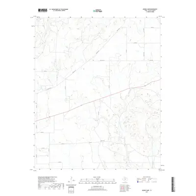
2019 Map of Moons Camp
USGS Topo · Published 2019About this map
Moons Camp occupies a central position within this portion of Cottle County, situated in a landscape defined by the drainage networks of Shorty Cr and Cottonwood Cr. The terrain is characterized by intricate contouring that reveals the erosional patterns of the local creek systems, including E Cottonwood Cr in the southeastern corner. Transportation throughout this rural expanse relies on a grid of county roads and key state-maintained routes such as FM 104 and Ranch Rd 104. The map illustrates the sparsely settled nature of the region, where infrastructure is primarily designed to navigate the rugged breaks and watercourses typical of this part of West Texas. This 2019 survey provides a clear view of the modern land divisions and road network, including Ranch Rd 2532, which connects the high ground between the various creek branches.
Find a feature on this map
22 named features on this map. Tap any name to fly to it.
Don’t see what you’re looking for? This feature index may not catch every label — zoom into the map to look around manually.
Map Details
Editions of this 2019 Moons Camp Map
This is the sole edition of this map. No revisions or reprints were ever made.
Other maps of this area

1954 · Lubbock
USGS Topo · 1:250,000

1954 · Plainview
USGS Topo · 1:250,000

1958 · Plainview
USGS Topo · 1:250,000

1967 · Dunlap
USGS Topo · 1:24,000

1967 · Triangle Ranch
USGS Topo · 1:24,000
1967 · Baker
USGS Topo · 1:24,000

1967 · Paducah
USGS Topo · 1:24,000

1967 · Moons Camp
USGS Topo · 1:24,000
1967 · Swearingen
USGS Topo · 1:24,000

1968 · Y Ranch
USGS Topo · 1:24,000