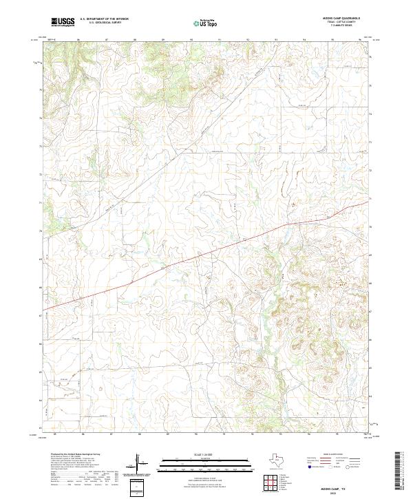
2022 Map of Moons Camp
USGS Topo · Published 2022About this map
Shorty Cr and Cottonwood Cr wind through the ranch lands of Cottle County in this modern survey of the Moons Camp area. The landscape is defined by the dendritic drainage patterns of these creeks as they cut through the north Texas plains, eventually reaching toward E Cottonwood Cr and Otter Cr. This map captures a largely rural, open environment where transportation is facilitated by a grid of local county roads and key state-maintained routes such as Ranch Rd 104 and Fm 104. The lack of dense residential development emphasizes the cattle-ranching character of this region, providing a clear view of current land management and the natural watercourses that have shaped its use over generations. It is a vital record for understanding the contemporary topography of this specific corner of the Rolling Plains.
Find a feature on this map
22 named features on this map. Tap any name to fly to it.
Don’t see what you’re looking for? This feature index may not catch every label — zoom into the map to look around manually.
Map Details
Editions of this 2022 Moons Camp Map
This is the sole edition of this map. No revisions or reprints were ever made.
Other maps of this area

1954 · Lubbock
USGS Topo · 1:250,000

1954 · Plainview
USGS Topo · 1:250,000

1958 · Plainview
USGS Topo · 1:250,000

1967 · Dunlap
USGS Topo · 1:24,000

1967 · Triangle Ranch
USGS Topo · 1:24,000
1967 · Baker
USGS Topo · 1:24,000

1967 · Paducah
USGS Topo · 1:24,000

1967 · Moons Camp
USGS Topo · 1:24,000
1967 · Swearingen
USGS Topo · 1:24,000

1968 · Y Ranch
USGS Topo · 1:24,000