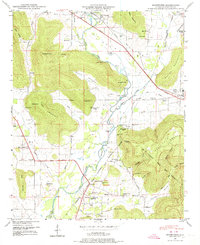
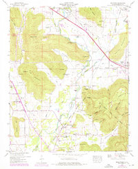
1948 Map of Moontown
USGS Topo · Published 1974About this map
The Flint River meanders through this portion of Madison County, Alabama, defining a valley bordered by the heights of Drake Mountain and Keel Mountain. In the late 1940s, this landscape was characterized by small agricultural settlements and family-named hollows like Potts Hollow and Mills Hollow. The community of Moontown sits near the river's edge, while Lickskillet occupies higher ground to the south. Educational and religious life centered on local landmarks such as Big Cove School, Berkley Sch, and Beech Grove Church.
Find a feature on this map
79 named features on this map. Tap any name to fly to it.
Don’t see what you’re looking for? This feature index may not catch every label — zoom into the map to look around manually.
Map Details
Editions of this 1948 Moontown Map
5 editions found
Other maps of this area

1888 · Scottsboro
USGS Topo · 1:125,000

1888 · Huntsville
USGS Topo · 1:125,000

1892 · Huntsville
USGS Topo · 1:125,000

1892 · Scottsboro
USGS Topo · 1:125,000

1936 · New Hope
USGS Topo · 1:24,000

1936 · Meridianville
USGS Topo · 1:24,000

1936 · Moontown
USGS Topo · 1:24,000

1936 · Hollytree
USGS Topo · 1:24,000

1936 · Grant
USGS Topo · 1:24,000

1936 · Maysville
USGS Topo · 1:24,000