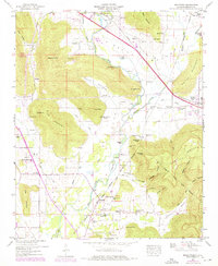
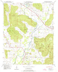
1948 Map of Moontown
USGS Topo · Published 1976About this map
Flint River valley life in the late 1940s is defined by the sharp transition between fertile bottomlands and the steep slopes of Keel Mountain and Drake Mountain. The Southern Railway and Lee Highway anchor the settlement at Gurley, while smaller communities like Moontown, Lickskillet, and Berkley are scattered along the foothills. The presence of the Wilson Reservation and the Cherokee Lands Boundary reflect the complex history of land tenure and displacement in this part of Madison County. Geologic and recreational interest is highlighted by Brazelton Cave and the eastern edge of Monte Sano State Park. This period shows a landscape of small rural schools like Big Cove School and Berkley Sch, alongside dozens of family burial grounds including Drake Cem and Brazelton Cem, illustrating the deep-rooted genealogical ties of the local population.
Find a feature on this map
70 named features on this map. Tap any name to fly to it.
Don’t see what you’re looking for? This feature index may not catch every label — zoom into the map to look around manually.
Map Details
Editions of this 1948 Moontown Map
5 editions found
Other maps of this area

1888 · Scottsboro
USGS Topo · 1:125,000

1888 · Huntsville
USGS Topo · 1:125,000

1892 · Huntsville
USGS Topo · 1:125,000

1892 · Scottsboro
USGS Topo · 1:125,000

1936 · New Hope
USGS Topo · 1:24,000

1936 · Meridianville
USGS Topo · 1:24,000

1936 · Moontown
USGS Topo · 1:24,000

1936 · Hollytree
USGS Topo · 1:24,000

1936 · Grant
USGS Topo · 1:24,000

1936 · Maysville
USGS Topo · 1:24,000