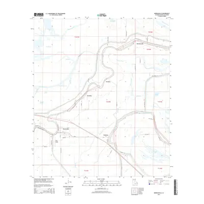
2015 Map of Moreauville
USGS Topo · Published 2015About this map
Moreauville serves as the primary hub in this low-lying landscape of the Atchafalaya Basin, where the meandering course of Bayou-des-Glaises dictates the placement of settlements and roads. The map reveals a high density of small communities and landing sites including Hamburg, Borodino, Voorhies, and Bordelonville. This area is defined by a complex network of waterways, from the Guillaume Slough to named lakes like Lac Didier and Fish Bayou Lake, indicating a terrain heavily influenced by seasonal water levels and alluvial deposition. The infrastructure of the mid-2010s is visible through local landmarks like Kent's Flying Service and religious sites such as Mount Zion Cem. Transportation follows the high ground along the bayous, with Hamburg Rd and Levee Rd tracing the natural and man-made barriers against the surrounding wetlands.
Find a feature on this map
56 named features on this map. Tap any name to fly to it.
Don’t see what you’re looking for? This feature index may not catch every label — zoom into the map to look around manually.
Map Details
Editions of this 2015 Moreauville Map
This is the sole edition of this map. No revisions or reprints were ever made.
Other maps of this area

1940 · Marksville
USGS Topo · 1:62,500

1941 · Voorhies
USGS Topo · 1:62,500

1948 · Bunkie
USGS Topo · 1:62,500

1952 · Lake Charles
USGS Topo · 1:250,000

1953 · Alexandria
USGS Topo · 1:250,000

1953 · Natchez
USGS Topo · 1:250,000

1954 · Lake Charles
USGS Topo · 1:250,000

1954 · Baton Rouge
USGS Topo · 1:250,000

1955 · Odenburg
USGS Topo · 1:62,500

1955 · Alexandria
USGS Topo · 1:250,000