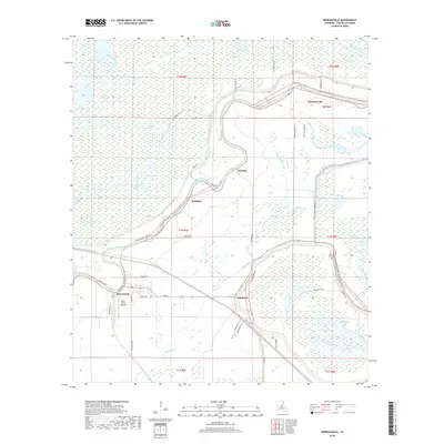
2018 Map of Moreauville
USGS Topo · Published 2018About this map
Moreauville and the surrounding Avoyelles Parish landscape are defined by the intricate hydrology of the Red River basin, where ancient distributary channels like Bayou des Glaises and La Vieille Riviere snake through low-lying terrain. The map captures a transition from concentrated residential cores in settlements like Hamburg and Bordelonville to the sprawling wetlands of Pomme De Terre Swamp. A distinct aviation landmark, Kent's Flying Service, sits west of the Moreauville town center, highlighting the importance of light aircraft in this rural, water-threaded region.
Find a feature on this map
61 named features on this map. Tap any name to fly to it.
Don’t see what you’re looking for? This feature index may not catch every label — zoom into the map to look around manually.
Map Details
Editions of this 2018 Moreauville Map
This is the sole edition of this map. No revisions or reprints were ever made.
Other maps of this area

1940 · Marksville
USGS Topo · 1:62,500

1941 · Voorhies
USGS Topo · 1:62,500

1948 · Bunkie
USGS Topo · 1:62,500

1952 · Lake Charles
USGS Topo · 1:250,000

1953 · Alexandria
USGS Topo · 1:250,000

1953 · Natchez
USGS Topo · 1:250,000

1954 · Lake Charles
USGS Topo · 1:250,000

1954 · Baton Rouge
USGS Topo · 1:250,000

1955 · Odenburg
USGS Topo · 1:62,500

1955 · Alexandria
USGS Topo · 1:250,000