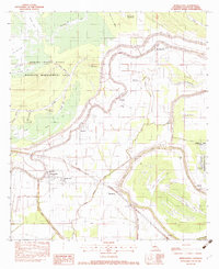
1982 Map of Moreauville
USGS Topo · Published 1983About this map
Bayou des Glaises snakes across this Avoyelles Parish landscape, its tight oxbows and natural levees dictating the placement of historic Acadian and Creole settlements. The map illustrates a classic Louisiana riverine settlement pattern, where narrow land tracts extend back from the bayou banks. The Kansas City Southern railroad cuts a straight diagonal through this winding hydrology, passing through the town of Moreauville and the community of Hamburg.
Find a feature on this map
58 named features on this map. Tap any name to fly to it.
Don’t see what you’re looking for? This feature index may not catch every label — zoom into the map to look around manually.
Map Details
Editions of this 1982 Moreauville Map
This is the sole edition of this map. No revisions or reprints were ever made.
Other maps of this area

1940 · Marksville
USGS Topo · 1:62,500

1941 · Voorhies
USGS Topo · 1:62,500

1948 · Bunkie
USGS Topo · 1:62,500

1952 · Lake Charles
USGS Topo · 1:250,000

1953 · Alexandria
USGS Topo · 1:250,000

1953 · Natchez
USGS Topo · 1:250,000

1954 · Lake Charles
USGS Topo · 1:250,000

1954 · Baton Rouge
USGS Topo · 1:250,000

1955 · Odenburg
USGS Topo · 1:62,500

1955 · Alexandria
USGS Topo · 1:250,000