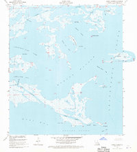
1955 Map of Morgan Harbor
USGS Topo · Published 1971About this map
Bayou La Loutre cuts through the marshy landscape of St. Bernard Parish, illustrating the complex hydrology of the Mississippi River Delta in the mid-1950s. This coastal survey reveals a labyrinth of saltwater bodies including Christmas Camp Lake, White Log Lake, and Skiff Lake, separated by fragile islands and points. Named features such as Dry Bread Island, Rawhead Island, and Comfort Island speak to the history of local navigation and camp life in these outer reaches. The transition from protected waters like Treasure Bay to the open expanse of Chandeleur Sound and Breton Sound is marked by tidal passes such as Chicot Pass and Scow Pass. In the center of the sheet, Morgan Harbor and its associated pass serve as a primary maritime waypoint, surrounded by a network of smaller bayous like Martinbox Bayou and Otter Bayou.
Find a feature on this map
31 named features on this map. Tap any name to fly to it.
Don’t see what you’re looking for? This feature index may not catch every label — zoom into the map to look around manually.
Map Details
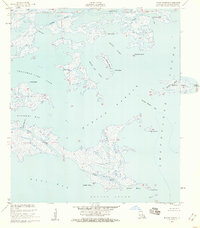
Editions of this 1955 Morgan Harbor Map
2 editions found
Other maps of this area

1893 · La Fortuna
USGS Topo · 1:62,500

1893 · Chandeleur
USGS Topo · 1:62,500

1895 · Bodreau
USGS Topo · 1:62,500

1935 · Morgan Harbor
USGS Topo · 1:31,680

1935 · Lake Athanasio
USGS Topo · 1:31,680

1935 · Mitchell Keys
USGS Topo · 1:31,680

1946 · Oak Mound Bayou
USGS Topo · 1:31,680

1946 · Lake Eugenie
USGS Topo · 1:31,680
1947 · Lake Athanasio
USGS Topo · 1:31,680
1947 · Lake Eloi
USGS Topo · 1:31,680