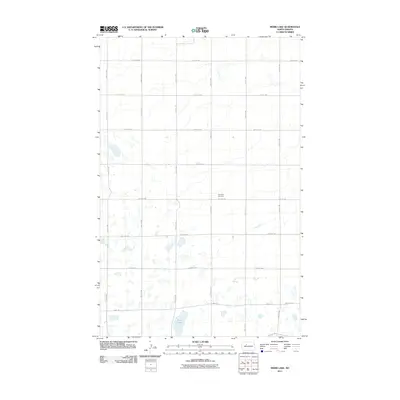
2011 Map of Mork Lake
USGS Topo · Published 2011About this map
Small wetlands and prairie potholes dot this section of the North Dakota landscape, centered around the waters of Mork Lake. The terrain is defined by a rigid section-line road grid that organizes the rural space, with routes such as 170th St NW and 54th Ave SW providing access to isolated farmsteads and agricultural plots. This 2011 survey by the U.S. Geological Survey shows a sparsely settled region where public and communal landmarks are rare, making the Township Cemetery a significant focal point for local history and genealogy. Located near the intersection of 170th St SW and 54th Ave, the cemetery represents a stable point of reference in an area otherwise characterized by vast fields and shifting water levels in unnamed basins across the quadrangle.
Find a feature on this map
24 named features on this map. Tap any name to fly to it.
Don’t see what you’re looking for? This feature index may not catch every label — zoom into the map to look around manually.
Map Details
Editions of this 2011 Mork Lake Map
This is the sole edition of this map. No revisions or reprints were ever made.
Other maps of this area

1928 · Minot
USGS Topo · 1:62,500

1948 · Burlington
USGS Topo · 1:24,000

1948 · Burlington
USGS Topo · 1:62,500

1948 · Minot NW
USGS Topo · 1:24,000

1949 · Minot NW
USGS Topo · 1:24,000

1950 · Des Lacs
USGS Topo · 1:24,000
1950 · Burlington
USGS Topo · 1:24,000
1951 · Burlington
USGS Topo · 1:62,500

1954 · Minot
USGS Topo · 1:250,000

1958 · Minot
USGS Topo · 1:250,000