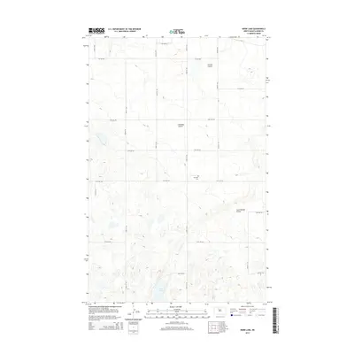
2014 Map of Mork Lake
USGS Topo · Published 2014About this map
Mork Lake anchors the southern portion of this prairie landscape, surrounded by the distinctive glacial depressions and small water bodies characteristic of the Ward County terrain. The survey captures a transition in the drainage patterns of the region, from the northern Larsons Coulee down through Gassman Coulee and South Branch Coulee. This rural expanse is organized by a precise grid of section-line roads, such as 170th St SW and 54th Ave SW, reflecting the systematic agricultural development of the North Dakota plains. A single pocket of local heritage is preserved at Township Cem, providing a focal point for genealogical interest amidst the surrounding fields. The presence of Prairie Trl suggests the continued importance of local access routes through the open country.
Find a feature on this map
25 named features on this map. Tap any name to fly to it.
Don’t see what you’re looking for? This feature index may not catch every label — zoom into the map to look around manually.
Map Details
Editions of this 2014 Mork Lake Map
This is the sole edition of this map. No revisions or reprints were ever made.
Other maps of this area

1928 · Minot
USGS Topo · 1:62,500

1948 · Burlington
USGS Topo · 1:24,000

1948 · Burlington
USGS Topo · 1:62,500

1948 · Minot NW
USGS Topo · 1:24,000

1949 · Minot NW
USGS Topo · 1:24,000

1950 · Des Lacs
USGS Topo · 1:24,000
1950 · Burlington
USGS Topo · 1:24,000
1951 · Burlington
USGS Topo · 1:62,500

1954 · Minot
USGS Topo · 1:250,000

1958 · Minot
USGS Topo · 1:250,000