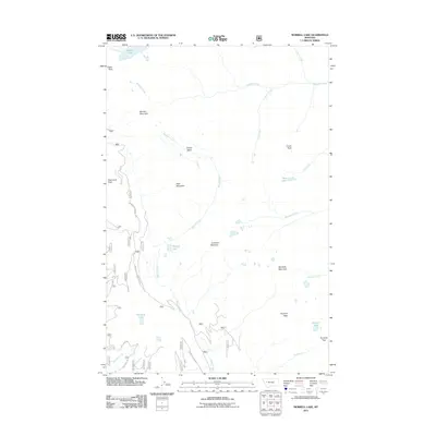
2011 Map of Morrell Lake
USGS Topo · Published 2011About this map
Morrell Lake and the dramatic drop of Morrell Falls anchor this high-elevation landscape in Missoula County, Montana. The terrain is defined by a succession of high summits, including Fisher Peak, Matt Mountain, and Marshall Mountain, which form the drainage basins for numerous alpine watercourses. Notable amongst these are Babcock Creek and the headwaters of Morrell Creek, which flows south through the center of the sheet. Access into this back-country is traced by the Morrell Clearwater Rd and the Rice Ridge Rd, which provide the primary transit corridors through the heavy timber and steep slopes. For those tracking geography near the Continental Divide, the map identifies specific crossing points like Pyramid Pass and remote basins such as Grizzly Basin, illustrating the primitive road network and hydraulic patterns as they existed in the early 21st century.
Find a feature on this map
34 named features on this map. Tap any name to fly to it.
Don’t see what you’re looking for? This feature index may not catch every label — zoom into the map to look around manually.
Map Details
Editions of this 2011 Morrell Lake Map
This is the sole edition of this map. No revisions or reprints were ever made.
Other maps of this area

1902 · Ovando
USGS Topo · 1:125,000

1905 · Ovando
USGS Topo · 1:125,000

1921 · Elbow Lake
USGS Topo · 1:125,000

1955 · Choteau
USGS Topo · 1:250,000

1957 · Choteau
USGS Topo · 1:250,000

1958 · Choteau
USGS Topo · 1:250,000

1962 · Choteau
USGS Topo · 1:250,000

1965 · Morrell Mountain
USGS Topo · 1:24,000

1965 · Holland Lake
USGS Topo · 1:24,000

1965 · Seeley Lake West
USGS Topo · 1:24,000