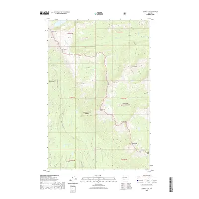
2020 Map of Morrell Lake
USGS Topo · Published 2020About this map
Lolo National Forest and Flathead National Forest meet at a rugged drainage divide in this high-altitude landscape of western Montana. The terrain is defined by a series of prominent peaks and basins, including Grizzly Basin and Matt Mtn. Water flows through the heart of the area via Morrell Creek, which feeds into the notable Morrell Falls before reaching Morrell Lake. This map captures the intricate hydrology of the region, from the headwaters of the East Fork Clearwater River in the northwest to the secluded waters of Florence Lake and George Lake. Evidence of access for management and recreation is visible via the Rice Ridge Road and Morrell-Clearwater Road, providing a modern view of this remote wilderness corridor where the borders of Missoula and Powell counties converge.
Find a feature on this map
42 named features on this map. Tap any name to fly to it.
Don’t see what you’re looking for? This feature index may not catch every label — zoom into the map to look around manually.
Map Details
Editions of this 2020 Morrell Lake Map
This is the sole edition of this map. No revisions or reprints were ever made.
Other maps of this area

1902 · Ovando
USGS Topo · 1:125,000

1905 · Ovando
USGS Topo · 1:125,000

1921 · Elbow Lake
USGS Topo · 1:125,000

1955 · Choteau
USGS Topo · 1:250,000

1957 · Choteau
USGS Topo · 1:250,000

1958 · Choteau
USGS Topo · 1:250,000

1962 · Choteau
USGS Topo · 1:250,000

1965 · Morrell Mountain
USGS Topo · 1:24,000

1965 · Holland Lake
USGS Topo · 1:24,000

1965 · Seeley Lake West
USGS Topo · 1:24,000