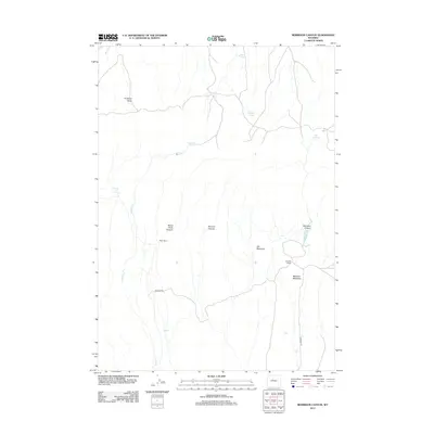
2012 Map of Morrison Canyon
USGS Topo · Published 2012About this map
Antelope Butte stands as a prominent landmark in this high-plains landscape of Fremont County, where the terrain is defined by a series of deep drainages and cattle ranching homesteads. The central portion of the map is dominated by the seasonal waters of Stagner Cr and the expansive Gill Meadows, indicating a region shaped by intermittent moisture and grazing. Settlement is sparse and focused on established agricultural holdings such as the Bean Ranch and Burgess Ranch.
Find a feature on this map
16 named features on this map. Tap any name to fly to it.
Don’t see what you’re looking for? This feature index may not catch every label — zoom into the map to look around manually.
Map Details
Editions of this 2012 Morrison Canyon Map
This is the sole edition of this map. No revisions or reprints were ever made.
Other maps of this area

1950 · Mexican Pass SW
USGS Topo · 1:24,000

1950 · Bonneville SW
USGS Topo · 1:24,000

1951 · Mexican Pass SE
USGS Topo · 1:24,000

1951 · Boysen
USGS Topo · 1:24,000

1951 · Mexican Pass
USGS Topo · 1:24,000

1951 · Morrison Canyon
USGS Topo · 1:24,000

1955 · Thermopolis
USGS Topo · 1:250,000

1958 · Thermopolis
USGS Topo · 1:250,000
1958 · Mexican Pass SE
USGS Topo · 1:24,000
1958 · Bonneville SW
USGS Topo · 1:24,000