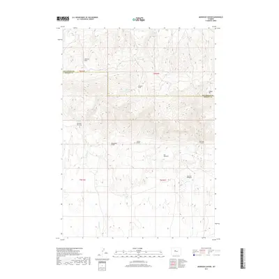
2017 Map of Morrison Canyon
USGS Topo · Published 2017About this map
Antelope Butte and Stagner Mtn dominate the northern landscape of this Wyoming quadrangle, marking the transition between Fremont Co and Hot Springs Co. The high-elevation terrain is defined by a complex network of seasonal water sources and deep drainage features, including Jergens Draw and Shearing Pen Draw. These natural depressions serve as vital corridors through the high country, leading down to relatively flat gathering points like Gill Meadows and Morrison Meadows.
Find a feature on this map
21 named features on this map. Tap any name to fly to it.
Don’t see what you’re looking for? This feature index may not catch every label — zoom into the map to look around manually.
Map Details
Editions of this 2017 Morrison Canyon Map
This is the sole edition of this map. No revisions or reprints were ever made.
Other maps of this area

1950 · Mexican Pass SW
USGS Topo · 1:24,000

1950 · Bonneville SW
USGS Topo · 1:24,000

1951 · Mexican Pass SE
USGS Topo · 1:24,000

1951 · Boysen
USGS Topo · 1:24,000

1951 · Mexican Pass
USGS Topo · 1:24,000

1951 · Morrison Canyon
USGS Topo · 1:24,000

1955 · Thermopolis
USGS Topo · 1:250,000

1958 · Thermopolis
USGS Topo · 1:250,000
1958 · Mexican Pass SE
USGS Topo · 1:24,000
1958 · Bonneville SW
USGS Topo · 1:24,000