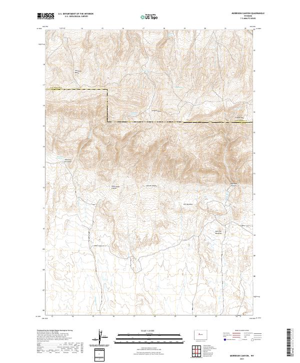
2021 Map of Morrison Canyon
USGS Topo · Published 2021About this map
Stagner Mtn and Antelope Butte dominate the high-elevation landscape of this 2021 survey, situated along the county line between Hot Springs and Fremont. The terrain is defined by a series of deep drainages including Morrison Canyon, Wood Road Canyon, and the appropriately named Smooth Canyon. This high-country environment contains essential water sources for livestock or wildlife, evidenced by named sites such as Jergens Spring, Nicholson Springs, and Shearing Pen Spring.
Find a feature on this map
21 named features on this map. Tap any name to fly to it.
Don’t see what you’re looking for? This feature index may not catch every label — zoom into the map to look around manually.
Map Details
Editions of this 2021 Morrison Canyon Map
This is the sole edition of this map. No revisions or reprints were ever made.
Other maps of this area

1950 · Mexican Pass SW
USGS Topo · 1:24,000

1950 · Bonneville SW
USGS Topo · 1:24,000

1951 · Mexican Pass SE
USGS Topo · 1:24,000

1951 · Boysen
USGS Topo · 1:24,000

1951 · Mexican Pass
USGS Topo · 1:24,000

1951 · Morrison Canyon
USGS Topo · 1:24,000

1955 · Thermopolis
USGS Topo · 1:250,000

1958 · Thermopolis
USGS Topo · 1:250,000
1958 · Mexican Pass SE
USGS Topo · 1:24,000
1958 · Bonneville SW
USGS Topo · 1:24,000