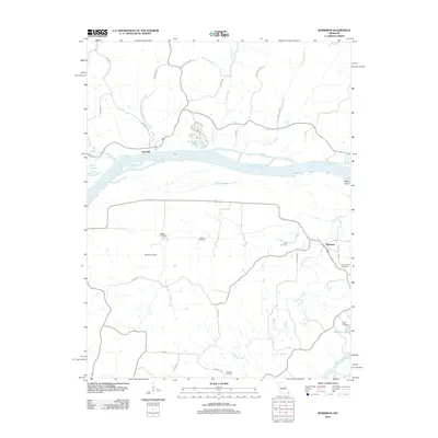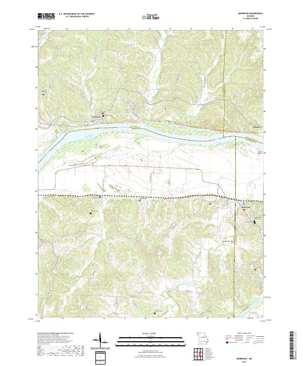
2021 Map of Morrison
USGS Topo · Published 2021About this map
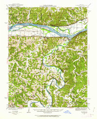
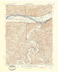
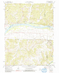
Morrison stands as a focal point along the southern bluffs of the Missouri River valley, where the convergence of the Missouri River and Gasconade River dominates the regional geography. This riverine landscape is defined by the broad Berger Bottom and the presence of Miller Island, illustrating the complex hydrological network that has shaped local transportation and agriculture for generations. The map reveals a high density of small family and community burial grounds, such as Townley Cem, Welton Cem, and Clary Cem, which provide significant genealogical clues for the area between Portland and Bluffton. North of the river, the Katy Trl follows the old rail corridor, while the upland terrain is dissected by numerous waterways including Tavern Cr and Logan Cr. This survey captures a mix of traditional river-bottom farming and the rugged ridge topography characteristic of the Missouri Ozarks border.
Find a feature on this map
73 named features on this map. Tap any name to fly to it.
Don’t see what you’re looking for? This feature index may not catch every label — zoom into the map to look around manually.
Map Details
Editions of this 2021 Morrison Map
This is the sole edition of this map. No revisions or reprints were ever made.
Historical Maps of Morrison Through Time
8 maps found