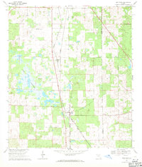
1969 Map of Morriston
USGS Topo · Published 1971About this map
The Seaboard Coast Line railroad forms the spine of this Levy County landscape, cutting a straight path through the settlements of Montbrook and Morriston. The terrain is defined by the expansive Lake Stafford to the west and a series of smaller depressions and karst features typical of north-central Florida. Near the northern boundary, the Williston Municipal Airport occupies a large clearing, while several small quarries dot the area, suggesting local lime rock extraction. Genealogists and local historians will find several burial sites preserved here, including Plummers Cem tucked away near the lake and Pleasant Hill Cem located near the Levy Co Marion Co line. The presence of a Jeep Trail in the northeast quadrant highlights the more sparsely developed woodlots that characterize the region's agricultural and rural nature during the late 1960s.
Find a feature on this map
12 named features on this map. Tap any name to fly to it.
Don’t see what you’re looking for? This feature index may not catch every label — zoom into the map to look around manually.
Map Details
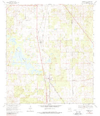
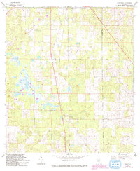
Editions of this 1969 Morriston Map
3 editions found
Other maps of this area

1892 · Dunnellon
USGS Topo · 1:62,500

1894 · Dunnellon
USGS Topo · 1:62,500

1895 · Williston
USGS Topo · 1:62,500

1954 · Romeo
USGS Topo · 1:24,000

1954 · Cotton Plant
USGS Topo · 1:24,000

1954 · Dunnellon
USGS Topo · 1:62,500

1954 · Gainesville
USGS Topo · 1:250,000

1955 · Tidewater
USGS Topo · 1:24,000

1955 · Bronson NE
USGS Topo · 1:24,000

1955 · Bronson SE
USGS Topo · 1:24,000