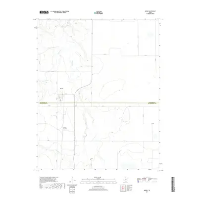
2019 Map of Morse
USGS Topo · Published 2019About this map
S Palo Duro Cr and N Palo Duro Cr carve deep drainage patterns across this High Plains landscape, marking the transition between Hansford and Hutchinson counties. The settlement of Morse serves as the primary hub, defined by a distinct grid of streets such as S 5th St and S 2nd St that reflect the town's organized growth. South of the main townsite, Morse Junction indicates a significant point in the local transportation network where roadways and paths converge near the creek bed.
Find a feature on this map
22 named features on this map. Tap any name to fly to it.
Don’t see what you’re looking for? This feature index may not catch every label — zoom into the map to look around manually.
Map Details
Editions of this 2019 Morse Map
This is the sole edition of this map. No revisions or reprints were ever made.
Other maps of this area

1953 · Stinnett Station
USGS Topo · 1:24,000

1953 · Pringle
USGS Topo · 1:24,000

1954 · Perryton
USGS Topo · 1:250,000

1954 · Amarillo
USGS Topo · 1:250,000

1958 · Perryton
USGS Topo · 1:250,000

1958 · Amarillo
USGS Topo · 1:250,000

1962 · Hansford
USGS Topo · 1:24,000

1974 · Morse
USGS Topo · 1:24,000
1974 · Pollard Creek NE
USGS Topo · 1:24,000

1974 · Hannas Draw East
USGS Topo · 1:24,000