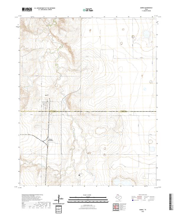
2022 Map of Morse
USGS Topo · Published 2022About this map
The town of Morse sits atop the high plains of the Texas Panhandle, positioned just north of the county line shared by Hansford Co and Hutchinson Co. This 2022 survey documents a landscape defined by the deep incisions of the S Palo Duro Cr and N Palo Duro Cr, which break the flat agricultural grid with their winding drainage patterns. The settlement of Morse Junction lies to the south of the main townsite, marking a point where the local transportation network converges.
Find a feature on this map
21 named features on this map. Tap any name to fly to it.
Don’t see what you’re looking for? This feature index may not catch every label — zoom into the map to look around manually.
Map Details
Editions of this 2022 Morse Map
This is the sole edition of this map. No revisions or reprints were ever made.
Other maps of this area

1953 · Stinnett Station
USGS Topo · 1:24,000

1953 · Pringle
USGS Topo · 1:24,000

1954 · Perryton
USGS Topo · 1:250,000

1954 · Amarillo
USGS Topo · 1:250,000

1958 · Perryton
USGS Topo · 1:250,000

1958 · Amarillo
USGS Topo · 1:250,000

1962 · Hansford
USGS Topo · 1:24,000

1974 · Morse
USGS Topo · 1:24,000
1974 · Pollard Creek NE
USGS Topo · 1:24,000

1974 · Hannas Draw East
USGS Topo · 1:24,000