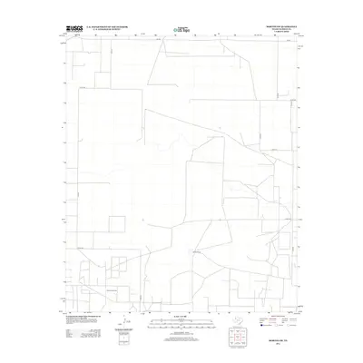
2012 Map of Morton SW
USGS Topo · Published 2012About this map
The vast agricultural and energy-rich landscape of Cochran County is defined by a rigorous grid of section roads and the infrastructure of the Permian Basin's northern reaches. At the southern edge of the survey, the Buckshot Oil Field underscores the region's industrial character, where resource extraction shares the land with large-scale ranching operations like the Masten Ranch. A complex network of county roads, including Co Rd-41, Co Rd-160, and Co Rd-200, facilitates movement across this open terrain, connecting isolated ranching hubs to the regional thoroughfare of Fm-769. This 2012 survey illustrates the enduring patterns of rural Texas land use, where the intersection of livestock ranching and oil production dictates the placement of roads and property boundaries.
Find a feature on this map
12 named features on this map. Tap any name to fly to it.
Don’t see what you’re looking for? This feature index may not catch every label — zoom into the map to look around manually.
Map Details
Editions of this 2012 Morton SW Map
This is the sole edition of this map. No revisions or reprints were ever made.
Other maps of this area

1954 · Brownfield
USGS Topo · 1:250,000

1958 · Brownfield
USGS Topo · 1:250,000

1962 · Brownfield
USGS Topo · 1:250,000

1969 · Lehman
USGS Topo · 1:24,000

1970 · Bronco NE
USGS Topo · 1:24,000

1970 · Bledsoe
USGS Topo · 1:24,000

1970 · Morton SW
USGS Topo · 1:24,000

1970 · Morton NW
USGS Topo · 1:24,000

1970 · Bledsoe NE
USGS Topo · 1:24,000

1971 · Schooler Ranch
USGS Topo · 1:24,000