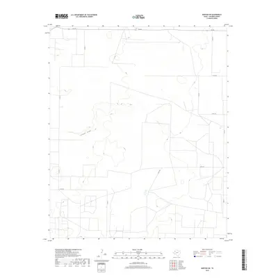
2019 Map of Morton SW
USGS Topo · Published 2019About this map
Sulphur Draw meanders across this High Plains landscape, serving as the primary drainage feature for this section of Cochran County. The 2019 survey illustrates the characteristic grid-pattern road network of West Texas, dominated by Farm to Market roads like FM 769 and a system of county routes such as Co Rd 41 and Co Rd 97. This territory is primarily agricultural, defined by sprawling land parcels and the occasional depression or playa characteristic of the Llano Estacado. The network of rural roads, including Co Rd 200 and Co Rd 55, provides a window into the modern land management and ranching infrastructure that sustains the region today. There are no major municipal centers on this sheet, offering a clear view of the open country and rural property divisions typical of the Texas Panhandle borderlands.
Find a feature on this map
11 named features on this map. Tap any name to fly to it.
Don’t see what you’re looking for? This feature index may not catch every label — zoom into the map to look around manually.
Map Details
Editions of this 2019 Morton SW Map
This is the sole edition of this map. No revisions or reprints were ever made.
Other maps of this area

1954 · Brownfield
USGS Topo · 1:250,000

1958 · Brownfield
USGS Topo · 1:250,000

1962 · Brownfield
USGS Topo · 1:250,000

1969 · Lehman
USGS Topo · 1:24,000

1970 · Bronco NE
USGS Topo · 1:24,000

1970 · Bledsoe
USGS Topo · 1:24,000

1970 · Morton SW
USGS Topo · 1:24,000

1970 · Morton NW
USGS Topo · 1:24,000

1970 · Bledsoe NE
USGS Topo · 1:24,000

1971 · Schooler Ranch
USGS Topo · 1:24,000