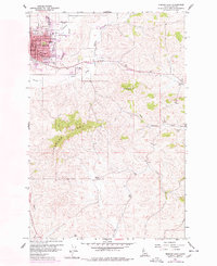
1960 Map of Moscow East
USGS Topo · Published 1978About this map
Moscow's eastward expansion and rural surroundings are documented in this mid-century survey, which records a landscape transitioning from the city center to high prairie ridges. The street grid, including B Street and 6th St, anchors the northwest corner of the map, while the Burlington Northern line cuts a steady path eastward past the Golf Course toward the small siding of Joel. The local geography is dominated by the steep ascent of Paradise Ridge and the prominent Tomer Butte, which separate the urban drainage of Paradise Creek from the southern waters of Thorn Creek. Genealogists and local historians can find a wealth of specific landmarks, from the St Marys Sch and Russell Sch in the residential core to the quiet Buchanan Cem on the eastern hills. The map also identifies rural community centers such as the Blaine Community Hall, reflecting the decentralized social life of Latah County before modern consolidation.
Find a feature on this map
36 named features on this map. Tap any name to fly to it.
Don’t see what you’re looking for? This feature index may not catch every label — zoom into the map to look around manually.
Map Details
Editions of this 1960 Moscow East Map
3 editions found
Other maps of this area

1910 · Pullman
USGS Topo · 1:125,000

1955 · Pullman
USGS Topo · 1:250,000

1958 · Pullman
USGS Topo · 1:250,000

1960 · Troy
USGS Topo · 1:24,000

1960 · Robinson Lake
USGS Topo · 1:24,000

1960 · Moscow Mtn
USGS Topo · 1:24,000

1960 · Moscow East
USGS Topo · 1:24,000

1960 · Potlatch
USGS Topo · 1:62,500

1961 · Moscow
USGS Topo · 1:62,500

1964 · Viola
USGS Topo · 1:24,000