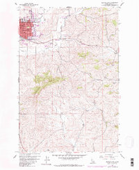
1960 Map of Moscow East
USGS Topo · Published 1982About this map
The eastern edge of Moscow anchors this 1960 landscape, showing the city's growth toward the foothills of Paradise Ridge. This map reflects the mid-century infrastructure of the Idaho Panhandle, where the Burlington Northern railroad corridors parallel the Palouse River South Fork and Valley Creek. Education and civic life are prominent in the platting, with several local institutions including Russell Sch, St Marys Sch, and the Whitworth Sch clustered near the town center.
Find a feature on this map
32 named features on this map. Tap any name to fly to it.
Don’t see what you’re looking for? This feature index may not catch every label — zoom into the map to look around manually.
Map Details
Editions of this 1960 Moscow East Map
3 editions found
Other maps of this area

1910 · Pullman
USGS Topo · 1:125,000

1955 · Pullman
USGS Topo · 1:250,000

1958 · Pullman
USGS Topo · 1:250,000

1960 · Troy
USGS Topo · 1:24,000

1960 · Robinson Lake
USGS Topo · 1:24,000

1960 · Moscow Mtn
USGS Topo · 1:24,000

1960 · Moscow East
USGS Topo · 1:24,000

1960 · Potlatch
USGS Topo · 1:62,500

1961 · Moscow
USGS Topo · 1:62,500

1964 · Viola
USGS Topo · 1:24,000