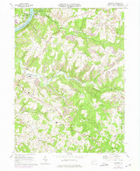
1968 Map of Mosgrove
USGS Topo · Published 1975About this map
The Allegheny River defines the western edge of this landscape, where the Penn Central and B & O RR corridor supports the riverside settlements of Bridgeburg and Mosgrove. Moving inland, the terrain is deeply dissected by several major watercourses, including Cowanshannock Creek and its many tributaries like Spro Run and Rupp Run. The area's mid-century industrial footprint is evident in numerous strip mines that dot the ridges between Boggs and Plumcreek townships.
Find a feature on this map
49 named features on this map. Tap any name to fly to it.
Don’t see what you’re looking for? This feature index may not catch every label — zoom into the map to look around manually.
Map Details
Editions of this 1968 Mosgrove Map
4 editions found
Other maps of this area

1900 · Kittanning
USGS Topo · 1:62,500

1901 · Rural Valley
USGS Topo · 1:62,500

1902 · Kittanning
USGS Topo · 1:62,500

1902 · Elders Ridge
USGS Topo · 1:62,500

1903 · Rural Valley
USGS Topo · 1:62,500

1904 · Elders Ridge
USGS Topo · 1:62,500

1907 · Freeport
USGS Topo · 1:62,500

1909 · Freeport
USGS Topo · 1:62,500

1953 · Pittsburgh
USGS Topo · 1:250,000

1954 · Pittsburgh
USGS Topo · 1:250,000