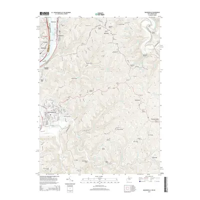
2014 Map of Moundsville
USGS Topo · Published 2014About this map
The Ohio River corridor defines the western edge of this Marshall County landscape, where industrial riverfront towns like Moundsville, McMechen, and Benwood are squeezed between the water and the rising slopes of The Narrows. At the heart of Moundsville, the Grave Creek Indian Mound stands as a significant archaeological landmark amidst the grid of city streets. The surrounding uplands are a complex network of ridges and hollows, including Waymans Ridge and Blairs Ridge, which host numerous small family and community burial grounds such as McHenry Cem and the Shafer Farm Cem. Further east, the landscape transitions toward the Prabhupada Spring near Limestone, illustrating the unique cultural layers of the region. This 2014 survey documents the modern infrastructure, from the Marshall County Airport to the Prison Cem, reflecting the area's diverse institutional and local history.
Find a feature on this map
180 named features on this map. Tap any name to fly to it.
Don’t see what you’re looking for? This feature index may not catch every label — zoom into the map to look around manually.
Map Details
Editions of this 2014 Moundsville Map
This is the sole edition of this map. No revisions or reprints were ever made.
Other maps of this area

1902 · Wheeling
USGS Topo · 1:62,500

1904 · Cameron
USGS Topo · 1:62,500

1905 · Clarington
USGS Topo · 1:62,500

1905 · St. Clairsville
USGS Topo · 1:62,500

1935 · Cameron
USGS Topo · 1:62,500

1935 · Clarington
USGS Topo · 1:62,500

1935 · Wheeling
USGS Topo · 1:62,500

1940 · Clarington
USGS Topo · 1:62,500

1942 · Cameron
USGS Topo · 1:62,500

1942 · Wheeling
USGS Topo · 1:62,500