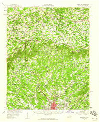
1957 Map of Mount Airy
USGS Topo · Published 1959About this map
Mount Airy serves as the focal point of this mid-century survey, anchoring a region where the foothills of North Carolina meet the rising slopes of the Blue Ridge. The town's 1950s infrastructure is captured in detail, from the Drive-in Theater and Filtration Plant to the communication towers for Wpaq and Wsyd. To the north, the Blue Ridge Parkway winds through the mountains, passing through Fancy Gap and near small rural communities like Gladesboro and Laurel Fork.
Find a feature on this map
87 named features on this map. Tap any name to fly to it.
Don’t see what you’re looking for? This feature index may not catch every label — zoom into the map to look around manually.
Map Details
Editions of this 1957 Mount Airy Map
2 editions found

Other maps of this area

1889 · Hillsville
USGS Topo · 1:125,000

1891 · Yadkinville
USGS Topo · 1:125,000

1892 · Hillsville
USGS Topo · 1:125,000

1893 · Yadkinville
USGS Topo · 1:125,000

1896 · Hillsville
USGS Topo · 1:125,000

1928 · Stuart
USGS Topo · 1:48,000

1930 · Max Meadows
USGS Topo · 1:62,500

1931 · Stuart
USGS Topo · 1:62,500

1931 · Galax
USGS Topo · 1:48,000

1933 · Galax
USGS Topo · 1:62,500