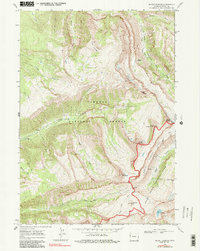
1968 Map of Mount Bannon
USGS Topo · Published 1987About this map
Grand Teton National Park and Targhee National Forest meet along a dramatic alpine divide in this late-1960s survey. The map document's high-altitude terrain is defined by the Teton Crest, where massive peaks such as Mount Bannon, Mount Jedediah Smith, and Mount Meek dominate the skyline. The survey identifies significant natural landmarks of interest to hikers and geologists, including the high-elevation Wind Cave and Ice Cave located near the headwaters of the South Fork Darby Creek.
Find a feature on this map
30 named features on this map. Tap any name to fly to it.
Don’t see what you’re looking for? This feature index may not catch every label — zoom into the map to look around manually.
Map Details
Editions of this 1968 Mount Bannon Map
2 editions found
Other maps of this area

1899 · Grand Teton
USGS Topo · 1:125,000

1901 · Grand Teton
USGS Topo · 1:125,000

1943 · Driggs
USGS Topo · 1:62,500

1946 · Driggs
USGS Topo · 1:62,500

1955 · Driggs
USGS Topo · 1:250,000

1958 · Driggs
USGS Topo · 1:250,000

1962 · Driggs
USGS Topo · 1:250,000

1965 · Clawson
USGS Topo · 1:24,000
1968 · Granite Basin
USGS Topo · 1:24,000
1968 · Teton Village
USGS Topo · 1:24,000