
1904 Map of Mount Carmel
USGS Topo · Published 1904About this map
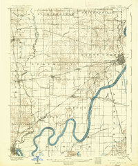
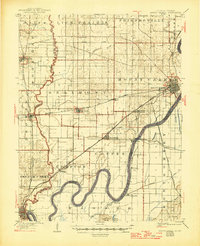
The Wabash River meanders across this landscape, serving as the fluid boundary between Illinois and Indiana. The river's deep loops, including those near Jimtown and Crowleyville, define a bottomland terrain marked by Foots Pond and the Foots Pond Hills. Along the western bank, the town of Mount Carmel emerges as a significant rail hub, where the Southern R. R. and the Louisville and St. Louis Line intersect.
Find a feature on this map
52 named features on this map. Tap any name to fly to it.
Don’t see what you’re looking for? This feature index may not catch every label — zoom into the map to look around manually.
Map Details
Editions of this 1904 Mount Carmel Map
3 editions found
Other maps of this area

1901 · Princeton
USGS Topo · 1:62,500

1901 · Haubstadt
USGS Topo · 1:62,500

1903 · Haubstadt
USGS Topo · 1:62,500

1903 · New Harmony
USGS Topo · 1:62,500

1903 · Princeton
USGS Topo · 1:62,500

1903 · Patoka
USGS Topo · 1:125,000

1911 · Sumner
USGS Topo · 1:62,500

1913 · Sumner
USGS Topo · 1:62,500

1915 · Vincennes
USGS Topo · 1:62,500

1938 · New Harmony
USGS Topo · 1:62,500