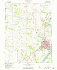
1959 Map of Mount Carmel
USGS Topo · Published 1961About this map
The Wabash River serves as a winding border between Illinois and Indiana in this late-1950s survey, anchoring the riverfront city of Mount Carmel. The urban grid is meticulously detailed, showing the Courthouse and City Bldg at its heart, alongside several neighborhood schools like North Sch and South Sch. Just outside the city center, the intersection of culture and industry is visible through the presence of a Drive-in Theater and a Golf Course near the riverbanks.
Find a feature on this map
58 named features on this map. Tap any name to fly to it.
Don’t see what you’re looking for? This feature index may not catch every label — zoom into the map to look around manually.
Map Details
Editions of this 1959 Mount Carmel Map
4 editions found
Other maps of this area

1901 · Princeton
USGS Topo · 1:62,500

1903 · Princeton
USGS Topo · 1:62,500

1903 · Patoka
USGS Topo · 1:125,000

1904 · Mount Carmel
USGS Topo · 1:62,500

1911 · Sumner
USGS Topo · 1:62,500

1913 · Sumner
USGS Topo · 1:62,500

1915 · Vincennes
USGS Topo · 1:62,500

1944 · Vincennes
USGS Topo · 1:62,500

1956 · Vincennes
USGS Topo · 1:250,000

1957 · Vincennes
USGS Topo · 1:250,000