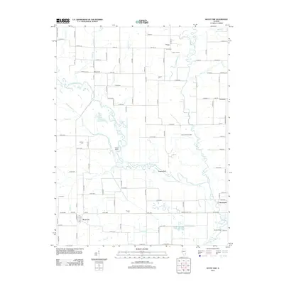
2012 Map of Mount Erie
USGS Topo · Published 2012About this map
Mount Erie serves as the primary hub in this rural landscape, situated south of the meandering Little Wabash River. The geography is defined by a complex network of waterways, including the Fox River, Moutray Slough, and engineered drainage features like Cross Diversion Ditch and Clear Pond Ditch. These water systems surround a series of small, scattered settlements such as Wynoose, Seminary, and Bennington.
Find a feature on this map
105 named features on this map. Tap any name to fly to it.
Don’t see what you’re looking for? This feature index may not catch every label — zoom into the map to look around manually.
Map Details
Editions of this 2012 Mount Erie Map
This is the sole edition of this map. No revisions or reprints were ever made.
Other maps of this area

1943 · Albion
USGS Topo · 1:62,500

1946 · Albion
USGS Topo · 1:62,500

1948 · Fairfield
USGS Topo · 1:62,500

1948 · Flora
USGS Topo · 1:62,500

1949 · Olney
USGS Topo · 1:62,500

1949 · Flora
USGS Topo · 1:62,500

1958 · Belleville
USGS Topo · 1:250,000

1962 · Belleville
USGS Topo · 1:250,000

1970 · Clay City
USGS Topo · 1:24,000

1970 · Enterprise
USGS Topo · 1:24,000