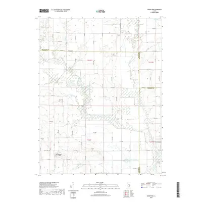
2018 Map of Mount Erie
USGS Topo · Published 2018About this map
Mount Erie sits at the heart of this landscape, surrounded by the alluvial bottomlands of the Little Wabash River. This area is characterized by its complex drainage network, where natural features like Goose Pond, Old River Lake, and the sharp bend at Totten Bend meet human engineered systems such as the Cross Diversion Ditch and Clear Pond Ditch. The map details a dispersed rural settlement pattern anchored by small clusters like Wynoose and Bennington. Genealogists will find a wealth of family-named landmarks and resting places, including Gallagher Cem, Moutray Cem, and Scott Cem. Along the river’s edge, Rutgers Bluff rises as a distinct topographical feature, while the Dorsey Bridge provides a vital crossing point in the southeastern corner. The grid of county roads, such as Co RD 1850n and Co RD 2200n, reveals the structured agricultural layout of Wayne County.
Find a feature on this map
65 named features on this map. Tap any name to fly to it.
Don’t see what you’re looking for? This feature index may not catch every label — zoom into the map to look around manually.
Map Details
Editions of this 2018 Mount Erie Map
This is the sole edition of this map. No revisions or reprints were ever made.
Other maps of this area

1943 · Albion
USGS Topo · 1:62,500

1946 · Albion
USGS Topo · 1:62,500

1948 · Fairfield
USGS Topo · 1:62,500

1948 · Flora
USGS Topo · 1:62,500

1949 · Olney
USGS Topo · 1:62,500

1949 · Flora
USGS Topo · 1:62,500

1958 · Belleville
USGS Topo · 1:250,000

1962 · Belleville
USGS Topo · 1:250,000

1970 · Clay City
USGS Topo · 1:24,000

1970 · Enterprise
USGS Topo · 1:24,000