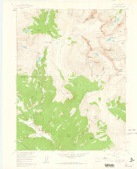
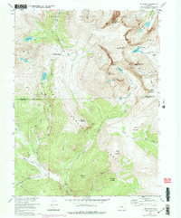
1957 Map of Mount Evans
USGS Topo · Published 1962About this map
Mt Evans and the high peaks of the Front Range dominate this mid-century topographic survey, where the boundaries of Arapaho National Forest and Pike National Forest meet. The landscape is defined by its extreme alpine hydrology, featuring high-elevation basins like the Chicago Lakes and Summit Lake, which sits at the foot of Mt Warren. Human presence is marked by high-altitude infrastructure, including the Shelter Cabin near the summit and the Roberts Diversion Tunnel cutting through the southern granite. Access into the wilderness is documented through a network of Pack Trails and the Chicago Lakes Trail, while the traverse at Guanella Pass provides the primary passage between the South Clear Creek and Geneva Creek drainages. The map records the detailed glacial topography of landmarks like The Sawtooth and Mt Bierstadt before modern high-altitude tourism surged.
Find a feature on this map
44 named features on this map. Tap any name to fly to it.
Don’t see what you’re looking for? This feature index may not catch every label — zoom into the map to look around manually.
Map Details
Editions of this 1957 Mount Evans Map
5 editions found
Other maps of this area

1903 · Georgetown
USGS Topo · 1:62,500

1905 · Georgetown
USGS Topo · 1:62,500

1924 · Montezuma
USGS Topo · 1:62,500

1926 · Montezuma
USGS Topo · 1:62,500

1933 · Montezuma
USGS Topo · 1:62,500

1937 · Como
USGS Topo · 1:62,500

1945 · Shawnee
USGS Topo · 1:24,000

1945 · Mount Logan
USGS Topo · 1:24,000

1948 · Mount Logan
USGS Topo · 1:24,000

1948 · Shawnee
USGS Topo · 1:24,000