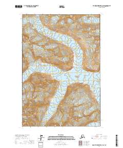
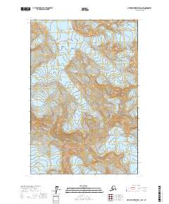
2017 Map of Mount Fairweather D-4 SW
USGS Topo · Published 2017About this map
Glacier Bay National Park dominates this high-altitude Alaskan landscape, where massive ice fields flow between the peaks of the Saint Elias Mountains. This 2017 survey documents a dramatic glacial environment, specifically the upper reaches of the Fairweather Range where several prominent ice rivers originate. These include the Margerie Glacier and the Johns Hopkins Glacier, which carve through the terrain as they move toward the coast. The map also traces the Tyeen Glacier and the John Glacier, providing a detailed record of their extent and the surrounding topography. The lack of human settlement or infrastructure underscores the remote and protected character of this wilderness area, where geological forces and ice movement remain the primary agents of change.
Find a feature on this map
12 named features on this map. Tap any name to fly to it.
Don’t see what you’re looking for? This feature index may not catch every label — zoom into the map to look around manually.
Map Details
Editions of this 2017 Mount Fairweather D-4 SW Map
This is the sole edition of this map. No revisions or reprints were ever made.
Other maps of this area

1951 · Mt Fairweather
USGS Topo · 1:250,000

1961 · Mount Fairweather D-4
USGS Topo · 1:63,360

1961 · Mount Fairweather D-5
USGS Topo · 1:63,360

1961 · Mount Fairweather C-4
USGS Topo · 1:63,360

1961 · Mount Fairweather C-5
USGS Topo · 1:63,360

1961 · Mt Fairweather
USGS Topo · 1:250,000
2017 · Mount Fairweather D-4 SE
USGS Topo · 1:25,000
2017 · Mount Fairweather D-4 NE
USGS Topo · 1:25,000
2017 · Mount Fairweather D-4 NW
USGS Topo · 1:25,000
2017 · Mount Fairweather C-4 NE
USGS Topo · 1:25,000