
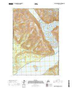
1961 Map of Mount Fairweather C-5
USGS Topo · Published 1966About this map
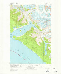
Glacier Bay National Monument dominates this coastal landscape, where the relentless movement of ice meets the Gulf of Alaska. The deep waters of Lituya Bay are framed by geologic features like Cenotaph Island and the distinctive peaks of The Paps. To the north, the massive Lituya Glacier feeds into Gilbert Inlet, while the southern portion of the map is defined by the expansive Crillon Lake and the convergence of the North Crillon and South Crillon Glacier. This 1961 survey captures a dynamic environment of shifting ice and water, including Desolation Valley and the Solomon Railroad formation. Landmarks like Harbor Point and La Chaussee Spit provide critical orientation along the shoreline, marking the entrance to one of the most geologically active corridors in the region.
Find a feature on this map
31 named features on this map. Tap any name to fly to it.
Don’t see what you’re looking for? This feature index may not catch every label — zoom into the map to look around manually.
Map Details
Editions of this 1961 Mount Fairweather C-5 Map
2 editions found
Other maps of this area

1951 · Mt Fairweather
USGS Topo · 1:250,000

1961 · Mount Fairweather D-4
USGS Topo · 1:63,360

1961 · Mount Fairweather D-6
USGS Topo · 1:63,360

1961 · Mount Fairweather D-5
USGS Topo · 1:63,360

1961 · Mount Fairweather C-4
USGS Topo · 1:63,360
1961 · Mount Fairweather C-6
USGS Topo · 1:63,360
1961 · Mt Fairweather B-4
USGS Topo · 1:63,360

1961 · Mt Fairweather
USGS Topo · 1:250,000
2017 · Mount Fairweather D-4 SW
USGS Topo · 1:25,000
2017 · Mount Fairweather C-5 NW
USGS Topo · 1:25,000