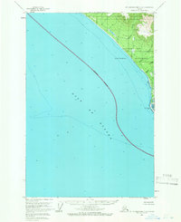
1961 Map of Mount Fairweather C-6
USGS Topo · Published 1966About this map
Glacier Bay National Monument dominates the northeastern corner of this coastal survey, where the rugged shoreline meets the expansive Gulf of Alaska. The landscape is defined by the shifting interface of land and sea, most notably at the La Chaussee Spit and an adjacent Tidal Flat. These coastal features were documented during a transitional period for the park's boundaries, noted here as an Indefinite Boundary extending into the gulf. Inland, the terrain is drained by several short, steep waterways including Justice Creek, Echo Creek, and Eagle Creek, which flow from the higher elevations of the Fairweather Range toward the coast. This 1961 field-annotated map provides a precise look at the hydrography and shoreline geomorphology before modern satellite mapping, capturing the literal edge of the North American continent in a period of relative isolation for the monument.
Find a feature on this map
9 named features on this map. Tap any name to fly to it.
Don’t see what you’re looking for? This feature index may not catch every label — zoom into the map to look around manually.
Map Details
Editions of this 1961 Mount Fairweather C-6 Map
2 editions found
Other maps of this area

1951 · Mt Fairweather
USGS Topo · 1:250,000
1961 · Mount Fairweather D-7
USGS Topo · 1:63,360

1961 · Mount Fairweather D-6
USGS Topo · 1:63,360

1961 · Mount Fairweather D-5
USGS Topo · 1:63,360

1961 · Mount Fairweather C-5
USGS Topo · 1:63,360

1961 · Mt Fairweather
USGS Topo · 1:250,000
2017 · Mount Fairweather D-6 SW
USGS Topo · 1:25,000
2017 · Mount Fairweather C-5 NW
USGS Topo · 1:25,000
2017 · Mount Fairweather D-6 SE
USGS Topo · 1:25,000
2017 · Mount Fairweather D-5 SW
USGS Topo · 1:25,000