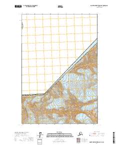
2017 Map of Mount Fairweather D-5 NE
USGS Topo · Published 2017About this map
Glacier Bay National Park dominates the southeastern half of this Alaskan quadrangle, where high-altitude ice fields meet the international boundary with Canada. The landscape is defined by massive glacial systems, notably the Margerie Glacier, which flows toward the east, and the Fairweather Glacier further west. In the southern reaches, the Johns Hopkins Glacier carves through the peaks, illustrating the immense scale of the glacial activity that has shaped this part of the Hoonah-Angoon Census Area. The survey provides a precise look at the township and range lines, such as t34s r48e and t35s r48e, as they were recorded in 2017, documenting the topography of these remote protected lands during the early 21st century.
Find a feature on this map
12 named features on this map. Tap any name to fly to it.
Don’t see what you’re looking for? This feature index may not catch every label — zoom into the map to look around manually.
Map Details
Editions of this 2017 Mount Fairweather D-5 NE Map
This is the sole edition of this map. No revisions or reprints were ever made.
Other maps of this area

1951 · Mt Fairweather
USGS Topo · 1:250,000

1952 · Skagway
USGS Topo · 1:250,000

1961 · Skagway A-7
USGS Topo · 1:63,360

1961 · Mount Fairweather D-4
USGS Topo · 1:63,360

1961 · Mount Fairweather D-5
USGS Topo · 1:63,360

1961 · Mt Fairweather
USGS Topo · 1:250,000

1961 · Skagway
USGS Topo · 1:250,000
2017 · Mount Fairweather D-4 SW
USGS Topo · 1:25,000
2017 · Mount Fairweather D-5 NW
USGS Topo · 1:25,000
2017 · Mount Fairweather D-4 NW
USGS Topo · 1:25,000