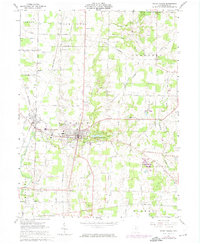
1961 Map of Mount Gilead
USGS Topo · Published 1974About this map
The village of Mount Gilead serves as the focal point of this Morrow County landscape, where the Penn Central railroad corridors converge near the neighboring village of Edison. This 1960s era view, updated with 1970s photogrammetric revisions, captures a network of rural townships including Canaan, Washington, and Congress. The terrain is defined by the upper reaches of Whetstone Creek and Big Walnut Creek, with the established Mount Gilead State Park and its Mount Gilead Lakes offering a dedicated recreational space amidst the surrounding agricultural land. Local history is anchored by numerous family cemeteries such as Armstrong Cem and Moffit Cem, alongside rural landmarks like the Mt Tabor Ch and Bryn Zion Ch. Transportation infrastructure of the period is prominent, from the Spring Valley Airport and a small Landing Strip to the grid of named country roads like Marion Williamsport Road and Treaty Line Road.
Find a feature on this map
69 named features on this map. Tap any name to fly to it.
Don’t see what you’re looking for? This feature index may not catch every label — zoom into the map to look around manually.
Map Details
Editions of this 1961 Mount Gilead Map
3 editions found
Other maps of this area

1913 · Mount Gilead
USGS Topo · 1:62,500

1915 · Shauck
USGS Topo · 1:62,500

1915 · Marengo
USGS Topo · 1:62,500

1915 · Fredericktown
USGS Topo · 1:62,500

1916 · Mount Gilead
USGS Topo · 1:62,500

1943 · Shauck
USGS Topo · 1:62,500

1943 · Marengo
USGS Topo · 1:62,500

1943 · Mount Gilead
USGS Topo · 1:62,500

1943 · Fredericktown
USGS Topo · 1:62,500

1950 · Marion
USGS Topo · 1:250,000