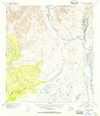
1952 Map of Mount Hayes A-6
USGS Topo · Published 1956About this map
The Clearwater Mountains dominate this high-altitude Alaskan landscape, where the drainage of the Maclaren River and its intricate network of tributaries defined the 1950s interior. This survey, conducted just years before Alaska's statehood, highlights the natural transit corridors through the terrain, most notably the Crazy Notch and an early Sled Road that follows the West Fork. These features reflect the era's reliance on winter-ready transport and natural geography for movement across the Territory. The western portion of the map is defined by the braided waters of Clearwater Creek and Little Clearwater Creek, which gather runoff from the surrounding peaks. To the east, the Maclaren River flows through a valley dotted with small lakes and marshy lowlands, including the area surrounding Osar Creek. This area provides a look at a transitional wilderness prior to more modern development or infrastructure.
Find a feature on this map
11 named features on this map. Tap any name to fly to it.
Don’t see what you’re looking for? This feature index may not catch every label — zoom into the map to look around manually.
Map Details
Editions of this 1952 Mount Hayes A-6 Map
3 editions found

Other maps of this area

1949 · Healy A-1
USGS Topo · 1:63,360

1949 · Mount Hayes A-5
USGS Topo · 1:63,360

1950 · Talkeetna Mountains
USGS Topo · 1:250,000

1950 · Mount Hayes
USGS Topo · 1:250,000

1950 · Healy B-1
USGS Topo · 1:63,360

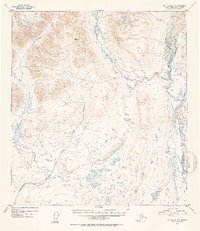
1950 · Mount Hayes A-6
USGS Topo · 1:63,360

1951 · Healy
USGS Topo · 1:250,000

1951 · Gulkana
USGS Topo · 1:250,000

1951 · Mount Hayes
USGS Topo · 1:250,000

1951 · Gulkana D-6
USGS Topo · 1:63,360