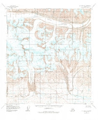
1951 Map of Mount Hayes B-5
USGS Topo · Published 1984About this map
Meteor Peak stands as a prominent high point in this glacial landscape within the Matanuska-Susitna Borough, as recorded during mid-century aerial surveys. The terrain is dominated by the massive ice fields of the Black Rapids Glacier and Eureka Glacier, which are marked with numerous crevasses that indicate the slow, steady movement of these frozen rivers. Below the glacial terminuses, the drainage patterns of the East Fork Maclaren River and Eureka Creek illustrate how glacial meltwater carves the surrounding topography. This map captures a region without established roads or permanent settlements, where the primary named features are topographical landmarks such as Broxson Gulch and smaller tributaries like Speckman Creek and West Fork Rainy Creek.
Find a feature on this map
10 named features on this map. Tap any name to fly to it.
Don’t see what you’re looking for? This feature index may not catch every label — zoom into the map to look around manually.
Map Details
Editions of this 1951 Mount Hayes B-5 Map
3 editions found
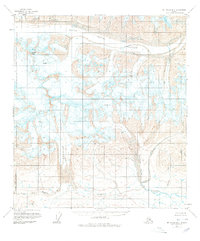
Other maps of this area

1949 · Mount Hayes A-4
USGS Topo · 1:63,360

1949 · Mount Hayes A-5
USGS Topo · 1:63,360

1950 · Mount Hayes
USGS Topo · 1:250,000

1950 · Mount Hayes C-4
USGS Topo · 1:63,360

1950 · Mount Hayes A-6
USGS Topo · 1:63,360

1951 · Mount Hayes
USGS Topo · 1:250,000

1951 · Mount Hayes B-6
USGS Topo · 1:63,360

1951 · Mount Hayes C-5
USGS Topo · 1:63,360

1951 · Mt. Hayes B-5
USGS Topo · 1:63,360

1951 · Mount Hayes C-6
USGS Topo · 1:63,360