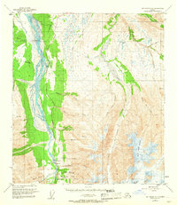
1950 Map of Mount Hayes C-4
USGS Topo · Published 1968About this map
Fort Greely dominates the northern reaches of this landscape, reflecting the military presence in the Alaska interior during the early Cold War era. The Richardson Highway serves as the primary artery through the region, paralleling the braided channels of the Delta River. This corridor supported a collection of small outposts and amenities for travelers, including the Black Rapids Club, a Campground, and a Diner near Donnelly.
Find a feature on this map
41 named features on this map. Tap any name to fly to it.
Don’t see what you’re looking for? This feature index may not catch every label — zoom into the map to look around manually.
Map Details
Editions of this 1950 Mount Hayes C-4 Map
4 editions found
Other maps of this area

1950 · Mount Hayes
USGS Topo · 1:250,000

1950 · Mount Hayes D-4
USGS Topo · 1:63,360

1950 · Mount Hayes C-4
USGS Topo · 1:63,360

1950 · Mount Hayes D-5
USGS Topo · 1:63,360

1951 · Mount Hayes
USGS Topo · 1:250,000

1951 · Mount Hayes C-5
USGS Topo · 1:63,360

1951 · Mt. Hayes B-5
USGS Topo · 1:63,360

1952 · Mount Hayes D-5
USGS Topo · 1:63,360

1952 · Mount Hayes D-4
USGS Topo · 1:63,360

1952 · Mount Hayes C-4
USGS Topo · 1:63,360