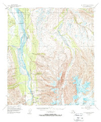
1950 Map of Mount Hayes C-4
USGS Topo · Published 1968About this map
Fort Greely dominates the northwestern portion of this mid-century survey, a period when the interior of Alaska was increasingly defined by strategic infrastructure. The Richardson Highway serves as the primary north-south artery, following the eastern bank of the Delta River and providing a lifeline for isolated outposts like the Diner and Black Rapids Club. This corridor represents a critical link between Fairbanks and the southern coast, where traveler services and early aviation facilities like the Rapids Landing Strip began to dot the landscape.
Find a feature on this map
34 named features on this map. Tap any name to fly to it.
Don’t see what you’re looking for? This feature index may not catch every label — zoom into the map to look around manually.
Map Details
Editions of this 1950 Mount Hayes C-4 Map
4 editions found
Other maps of this area

1950 · Mount Hayes
USGS Topo · 1:250,000

1950 · Mount Hayes D-4
USGS Topo · 1:63,360

1950 · Mount Hayes C-4
USGS Topo · 1:63,360

1950 · Mount Hayes D-5
USGS Topo · 1:63,360

1951 · Mount Hayes
USGS Topo · 1:250,000

1951 · Mount Hayes C-5
USGS Topo · 1:63,360

1951 · Mt. Hayes B-5
USGS Topo · 1:63,360

1952 · Mount Hayes D-5
USGS Topo · 1:63,360

1952 · Mount Hayes D-4
USGS Topo · 1:63,360

1952 · Mount Hayes C-4
USGS Topo · 1:63,360